File:On Air Map.png
Jump to navigation
Jump to search


Size of this preview: 600 × 600 pixels. Other resolutions: 240 × 240 pixels | 2,048 × 2,048 pixels.
Original file (2,048 × 2,048 pixels, file size: 6.63 MB, MIME type: image/png)
Summary
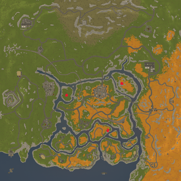
Map with the locations of the On Air quest broadcast towers
Licensing
This file is under the Creative Commons Attribution-ShareAlike 3.0 License.
File history
Click on a date/time to view the file as it appeared at that time.
| Date/Time | Thumbnail | Dimensions | User | Comment | |
|---|---|---|---|---|---|
| current | 15:41, 26 April 2024 | | 2,048 × 2,048 (6.63 MB) | ChipMashpin (talk | contribs) | Map with the locations of the On Air quest broadcast towers |
You cannot overwrite this file.
File usage
The following page uses this file: